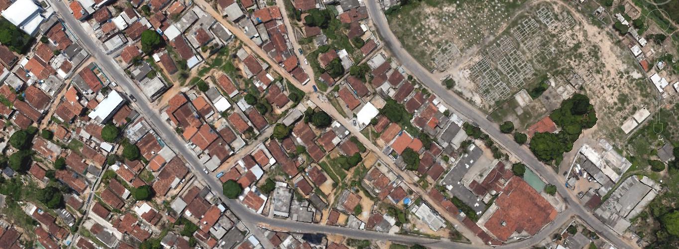
Satellite rendering of Nova Descorberta neighborhood. Recife, Brazil, February 16, 2016. (Google Earth)
The Zika virus continues to proliferate across Latin America. In a bid to rid the nation of the Aedes aegypti mosquito known to transmit the virus, Brazil mobilized nearly a quarter million military personnel for a one-day “mega operation” to exterminate breeding grounds. But as this so-called ground war rages on, could the newest weapon in the fight against Zika come from space?
In experimental studies, researchers are harnessing high-resolution satellite imagery and geographic information systems (GIS) to map, measure, and control the spread of mosquitoes that may carry Zika, dengue fever, and other harmful diseases. The rise of open-source satellite imagery, such as Google Earth; the proliferation of handheld GPS devices; and advances in GIS software mean that geospatial information is more widely accessible to public health officials. Image quality has also become sharper and more detailed, allowing researchers to more effectively visualize and project the spread of mosquito-borne illness.
Among diplomatic circles, satellite imagery is probably better known for its role in monitoring nuclear weapons buildup and searching for evidence of war crimes. As a result, using geospatial technology of this kind for public health purposes could lead to some skepticism among national authorities. At a time when global pandemics are becoming increasingly politicized, researchers will need to possess an awareness of the overarching political climate in which these interventions operate.
In 2009, researchers working with the Nicaraguan Ministry of Health piloted a project using Google Earth and ArcGIS to develop a surveillance system for dengue fever in two Nicaraguan cities. Like Zika, dengue fever is also carried by the Aedes aegypti and is endemic to Latin America.
The researchers used composite satellite maps to mark the homes of infected patients and sites of mosquito larval development such as garbage dumps, while field teams used handheld GPS devices to record their locations. The system mapped the location of 125 confirmed cases and approximately 600 suspected cases of dengue. This allowed researchers to analyze the geographic distribution of the outbreak, communicate needs for resources such as insecticide to public officials, and focus interventions on the most vulnerable neighborhoods.
Other projects have also shown promise. A 2014 study used satellite imagery to identify a sampling of households in Lilongwe, Malawi, in order to estimate the prevalence of malaria. A 2009 study tracked the spread of polio in the Democratic Republic of the Congo and was able to determine that the outbreak followed the course of the Congo River. Satellite maps revealed entire sections of the river that were not well documented and, subsequently, had been overlooked by polio vaccination workers.
Rajan Kulkarni, a physician and professor at the University of California, Los Angeles School of Medicine, and part of the research team in Nicaragua, told me that the surveillance system he helped pilot is “definitely feasible” for the Zika virus. Overlaying satellite maps and GPS coordinates in this manner “makes it much easier for follow-up surveillance, to ensure compliance with abatement efforts, and to determine additional steps or resources needed,” said Kulkarni, who is also a member of the Dengue Relief Foundation.
Although Kulkarni’s research team relied primarily on traditional field-based methods to collect data on mosquito breeding grounds, it’s also possible to directly observe from space large objects that are prone to mosquito infestation, such as cemeteries, landfills, and construction sites. The improved efficiency this allows could benefit health ministries in low-income settings, which often lack the resources and capacity to carry out intensive field work.
“Looking at direct observables can be very useful, particularly at the regional or national level where those working on the project might not have familiarity with the local terrain,” Kulkarni said. “This system would definitely have greater value in remote areas.”
Of course, satellite monitoring is not without limitations. Small objects such as puddles and barrels of standing water, which are ubiquitous in the poor, highly dense favelas of Brazil, are not visible on satellite maps. Field work is needed for fumigation and to mark GPS coordinates for areas without fixed street addresses. Cloud cover and heavily forested areas, such as the Amazon, can also obscure objects on the ground. While geospatial technology can provide critical support, it cannot replace on-the-ground mosquito control measures.
More prevalent than remote sensing, GIS technology is also providing valuable information on emerging infectious diseases. While epidemiologists have used cartographic information for centuries, the increasingly real-time nature of mapping—as well as the predictive power of spatial modelling—can help public health officials prepare for the next epidemic on their doorstep.
Healthmap, an initiative of the Boston Children’s Hospital, is working to deliver real-time geographic information on disease outbreaks via an automated process. Cases of Zika transmission are plotted in an interactive map. In a separate 2015 study, a team of researchers mapped the global distribution of the mosquito population, revealing their migration into southern Europe and northern United States. On March 3, Google announced that it is donating $1 million to UNICEF to fight Zika and working with the children’s agency to “map and anticipate the virus.”
Researchers are also applying sophisticated GIS models to predict the future geographical range of disease-carrying mosquitoes. Doug Fuller, a Professor of Biogeography at the University of Miami, told me he and his team are currently exploring ways to visualize and project the spread of Zika. In the past, Fuller used climate and environmental data obtained from weather satellites and other sources to forecast the growth of malaria and dengue fever in Central America and the Caribbean.
Besides Google Earth, governments in industrialized nations may have access to more sophisticated geospatial capabilities that provide near real-time, ultra-high-resolution imagery. Satellite monitoring has enabled officials from Brazil’s environmental protection agency to crack down on deforestation in the Amazon, for instance.
However, it’s not clear if the Brazilian government is drawing on these capabilities in the fight against Zika. Coordination is required to ensure this data finds its way from national geospatial intelligence agencies into the hands of relevant public health authorities. Singapore’s national environmental agency releases geospatial data on locations of dengue fever cases, for example.
Despite the promise of technological solutions, political realities can sometimes prove fatal to public health interventions. The growing awareness of global pandemics—and heightened level of scrutiny facing governments and health organizations—raises the possibility that projects of this kind will be viewed with suspicion.
In the past, governments have voiced concerns about the use of satellites over their territory as too intrusive or even “spying.” Under such a scenario, the government in question may be unwilling to share data or support programs that make use of these tools, especially if the results might paint the government in a bad light.
At a time when countries facing public health emergencies do not always cooperate with health authorities, these interventions will need to be increasingly tailored to the political context. “Even something as innocuous-sounding as mosquito abatement is always wrapped in politics,” Kulkarni said. “Someone not from the ministry of health may see this and worry there’s someone else coming in and looking at sensitive sites.”
Ultimately, these interventions cannot substitute for political will and dedication of resources towards effective national public health and disease surveillance systems. “The key is really the allocation of sufficient resources towards mosquito surveillance, cleanup, and abatement,” Kulkarni said. “Even the best satellite imagery isn’t going to show small objects, such as barrels of standing water, which must be confirmed through visual sighting.”
Aileen Chang, a physician and professor at George Washington University School of Medicine and a member of the Dengue Relief Foundation, told me that future advances in this technology will make it even more powerful. “The next big advancement coming is cloud-based real-time usage of GIS for by-the-minute outbreak and mosquito density mapping to guide control efforts,” she said. This real-time visualization could assist in rapidly evolving emergencies and would improve upon methods which rely on outdated visuals and data.
“This technology would be an efficient way to target areas where Aedes aegypti mosquitoes that may carry dengue, chikungunya, or Zika may reside,” Chang said. If public health actors can successfully scale up these pilot projects—and avoid political hurdles—then space might just be the next frontier in the fight against global pandemics.